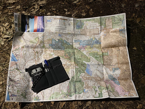
Fire roads and truck trails are a great way to get your feet wet when it comes to back country travel and backpacking. Lately with all of the shutdowns I have been exploring local places I have usually overlooked. This is a great way of getting acclimated and introducing new hikers to the fun of the outdoors.

Most of the time they are a part of our public lands and are within the areas that we can disperse camp, so it opens up a lot of opportunity for exploration. Many are well maintained so if you have a capable off-road car or truck you can drive them and pick out camp sites and see if the area is worth a little more exploration. Often well maintained they make hiking easier and the grads are not too steep (relatively speaking). They are also prominent terrain features which make navigation a little easier.

That being said there are a few things to consider like who’s land is it, out here these roads can criss cross many different owners from local, state, federal and private. Depending on weather and times of the year they can also be closed to prevent damage and people getting stuck. Speaking of weather and closures that can also affect your trip and how far you end up hiking. Lots of times we might drive in a bit to hike a different section, so open and closed gates make all of the difference.

Always bring a map, always bring a map (we have them here)… I love my cellphone and the GPS but batteries die when you run them, take pictures and play on social media, ha-ha. Also in many of these areas we do get a bar of reception here and there which is great for checking in or an emergency but there are also a ton of dead zones and you don’t want to 100 percent rely on the phone in my opinion.
Also like we usually say survival starts at home, doing you research can make a work of difference. Maps are great but keep in mind what it says is a truck trail can quickly turn into a trail trail in older unmaintained sections. I have come across this a few times where the road becomes a trail then a road again. So, stuff like google earth is great for getting a bird eye view before you go, again keeping in it can be an old pick as well.
Also keeping safety in mind remember these trails can be really exposed and water is not a guarantee in SoCal, we have had a pretty wet year as I’m writing this, and a few creeks are flowing but…. The water is often at the bottom of the canyon and well the roads might cross here and there they often are much higher on the hillside. Even when you are close and can hear the water getting to it might be a different story, its often overgrown and difficult to get to plus fun stuff like poison oak is often everywhere.

Continuing to harp on safety, remember fire roads are still road. Like I suggested driving it if you can to take a look keep in mind there are others in jeeps, on dirt bikes and mountain bikes so keep your head on a swivel. Don’t hike with music and listen that is one of your best defenses as these roads are narrow and you might have to hop up on the back to let them go by. A lot of these roads are best described as one lane so be aware around the corners as some people can drive fast.

So, if you want to get way on a small adventure check out your local fire roads and truck trails for a great hike and way to get in shape and test out gear. If you have issues you can get extracted a lot easier than on actual trail and often times, they are a great way to get away from the crowds of some of the busier trails. If you are in Socal, San Diego namely drop by the shop as we have a ton of maps and good trail ideas for you to get out on and explore. As always thanks for checking us out and happy hiking!


